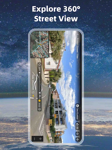
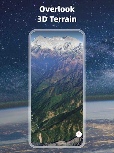
Earth 3D Map-StreetView Camera
Foxpoi
Downloads
10,000,000+
Version
Latest
Advertisement
Click to download now, finish the installation quickly, and directly unlock the "all-round experience"
Advertisement
Screenshots


Click to download now, finish the installation quickly, and directly unlock the "all-round experience"
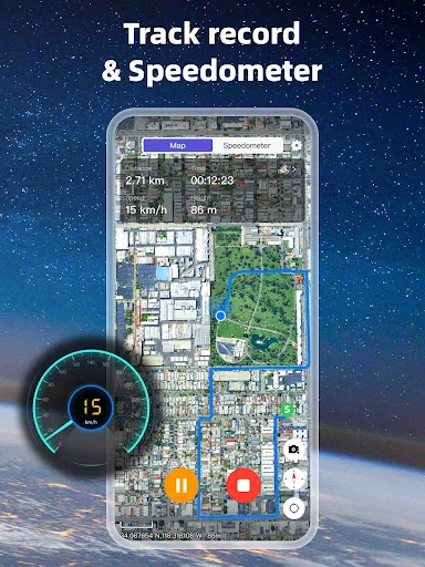
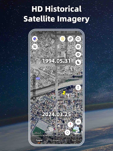
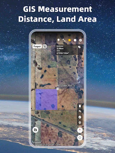
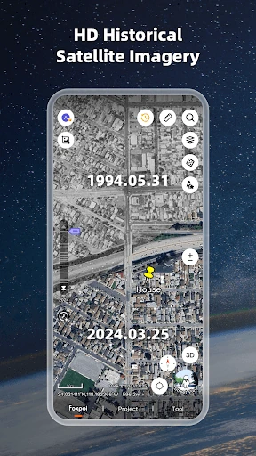
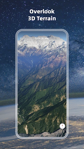
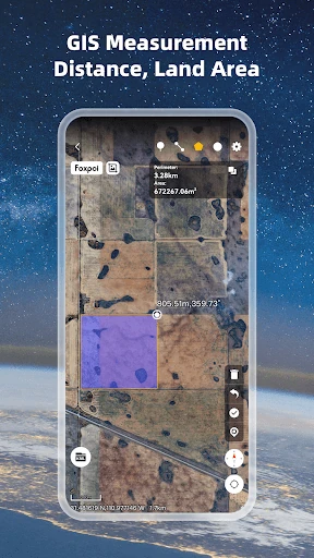
Earth 3D Map-StreetView Camera is a sophisticated entry in the Maps & Navigation category that successfully bridges the gap between casual virtual exploration and professional-grade geographic information systems (GIS). While most navigation apps focus on turn-by-turn directions, this platform prioritizes high-definition 3D visualization and technical data management. It serves as a comprehensive tool for users who need to analyze terrain, monitor urban development, or manage complex spatial data files on the go. Its authoritative presence in the market is solidified by its ability to render high-resolution satellite imagery while maintaining compatibility with industry-standard engineering formats.
The user interface of Earth 3D Map-StreetView Camera is built with a "map-first" philosophy, ensuring that the visual data remains the primary focus. The design language adheres to the standards expected within the Maps & Navigation category, utilizing intuitive gestures for 3D tilting, rotating, and zooming. For a tool with such deep technical capabilities—especially regarding GIS file management—the UX remains surprisingly accessible. The menu structures are logically organized to prevent technical fatigue, though the density of professional features suggests a UI optimized for efficiency rather than pure minimalism.
To further elevate the user experience, the developers should consider implementing an offline caching system for both satellite tiles and GIS layers, which would be invaluable for professionals working in remote areas. Additionally, adding a simplified "Lite Mode" could help bridge the gap for casual users who find the professional coordinate systems and file management tools distracting from the core exploration experience.
Earth 3D Map-StreetView Camera is a powerhouse tool specifically tailored for GIS professionals, land surveyors, and dedicated geography enthusiasts. It excels as a portable geographic workstation that offers much more than standard consumer maps. If you require a tool that can overlay complex data files on top of high-definition satellite imagery while providing precise coordinate tracking, this app is an essential recommendation. It is the go-to choice for those who need to carry the world—and their projects—in their pocket.